There is nothing more frustrating than standing on a mountain surrounded by magnificent peaks and not knowing what you are looking at. Fortunately, modern smartphones and computers now carry powerful digital elevation models capable of reconstructing the landscape around you and naming every summit in view. Whether you are a hiker, skier, photographer or simply curious, here are the best tools to identify mountains — on your phone in the field, or on your computer at home before you leave.
PeakFinder: the best mountain peak identifier app (paid)
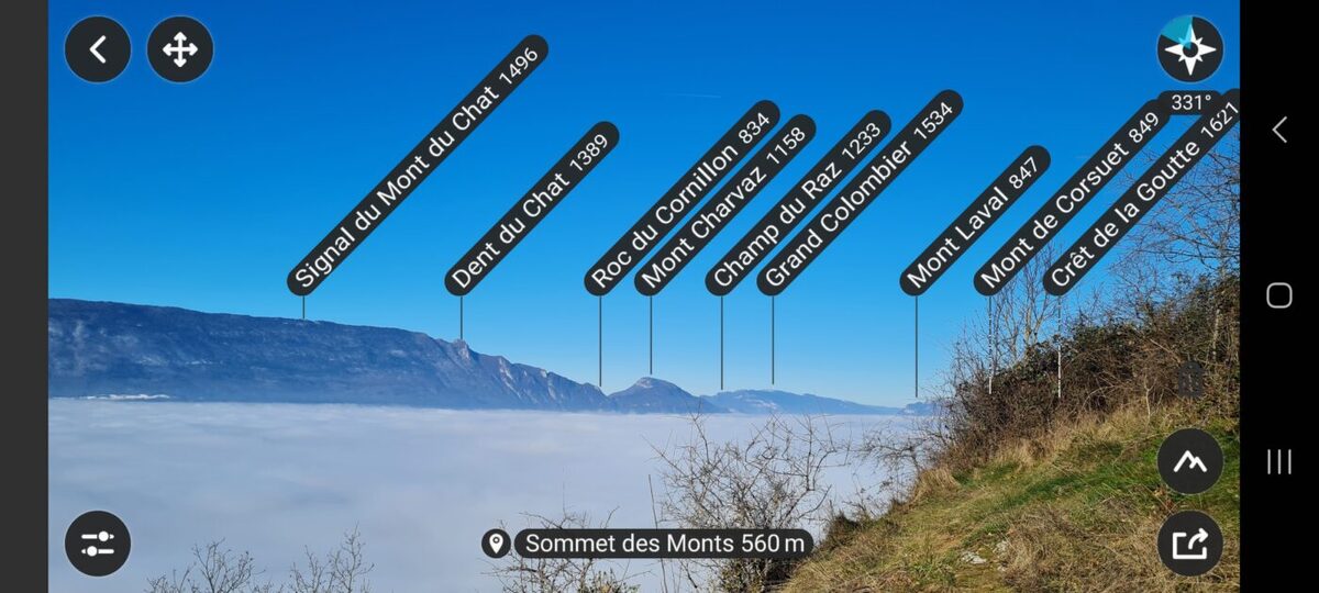
📒 Features:
- Identifies over 1 million summits worldwide.
- Works fully offline once data is downloaded.
- 360° panoramic view generated from your GPS position.
- Augmented reality overlay — point your phone at any mountain to see its name.
- Works on existing photos taken with any camera.
- Sun and moon trajectory overlay for any date (useful for planning photography).
❤️ Verdict: intuitive interface, comprehensive database, consistently accurate results.
💰 Price: around £4–5, one-off purchase. Available on iPhone and Android.
PeakFinder is the standout app in this category — and the one we use ourselves. Rather than simply overlaying text on a camera image, it generates a beautiful hand-drawn style panoramic sketch of the landscape around you, then labels every visible summit. You can zoom in with good precision, manually correct compass errors (which makes a significant difference on some phones), and reposition the mountains to improve accuracy.
Two features set it apart from the competition. First, the ability to overlay a panorama onto an existing photograph — so you can identify peaks in photos taken years ago with a DSLR. Second, the sun and moon trajectory tool, which shows exactly when and from which direction any mountain will catch the light on a given date — genuinely useful for hikers and photographers planning a shot.
The web version at peakfinder.org is also excellent — useful for planning a hike from home or exploring a route before you leave.
Our verdict: PeakFinder is the best mountain identifier app available — on any platform. The one-off price is very reasonable for what it delivers. If you buy only one app from this list, make it this one.
PeakFinder website · PeakFinder on Google Play · PeakFinder on the App Store
Here is a live example of PeakFinder showing the Alpine panorama visible from Lyon on a clear winter morning:
How to get the best results from any peak identifier app
The accuracy of any peak identifier app depends primarily on your phone’s compass and GPS. A few tips to get reliable results: calibrate your compass before using the app by moving the phone in a figure-of-eight motion (most apps will prompt you to do this); remove your phone case and any magnetic accessories, which can interfere with the compass; make sure you are outdoors with a clear sky view for GPS to lock accurately. On older or budget phones, manual compass correction — available in PeakFinder — makes a significant difference.
PeakVisor: the best free alternative
📒 Features:
- 3D maps with summit names, hiking trails and mountain refuges.
- Hiking trail and ski run information integrated.
- Works offline after data download.
- Summit recognition via smartphone camera.
- GPS track recording.
❤️ Verdict: ideal for hikers thanks to integrated topographic maps and trail data.
💰 Price: free with paid subscription for advanced features. Available on iPhone and Android.
PeakVisor is the closest rival to PeakFinder and the most feature-rich free option. Its combination of peak identification and topographic hiking maps makes it particularly useful for trail planning — you can see the route, the refuges and the summit names all in one place. The “teleportation” feature lets you virtually explore the view from any summit before you set off.
User reviews are more mixed than PeakFinder’s, however. The app has been reported to crash on some devices, and some users find the accuracy less consistent — particularly for summits at distance. The free version is functional but the full experience requires a subscription.
PeakVisor on Google Play · PeakVisor on the App Store
PeakLens: simple, free and effective
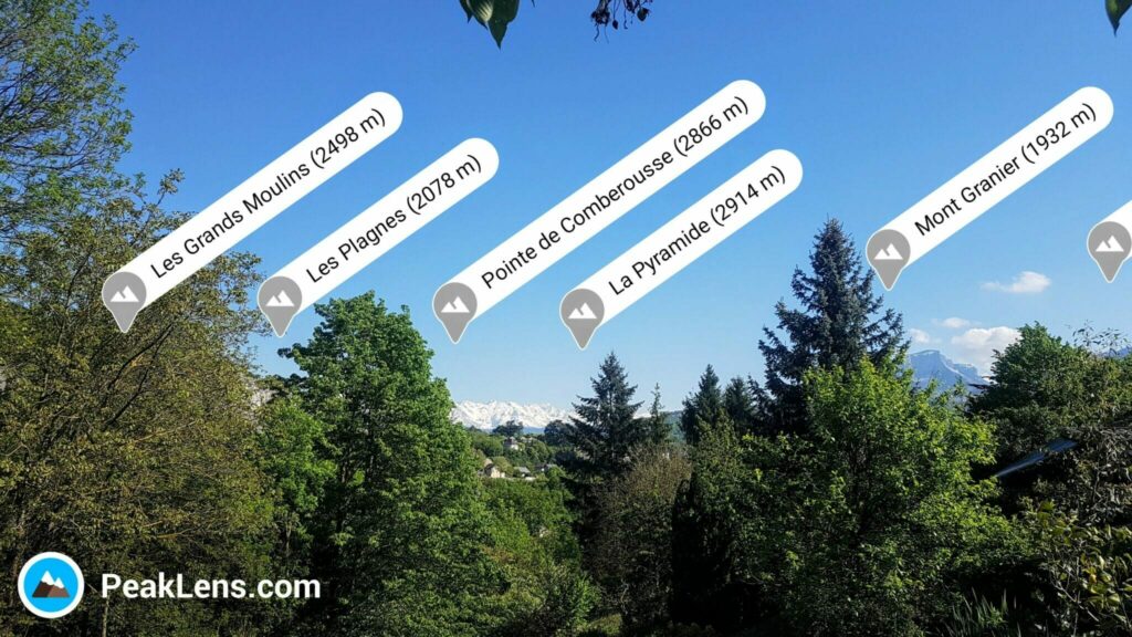
📒 Features:
- Augmented reality peak identification in real time.
- Precise calculations using GPS and gyroscope.
- Detailed geographic information for each summit.
- Photo capture with summit names overlaid.
❤️ Verdict: clean display, genuinely free, works well for most situations.
💰 Price: free, with some paid options. Android only.
PeakLens is a free augmented reality app that overlays summit names directly onto your camera view. The display is clean and the identification is reliable for most situations. Its main limitation compared to PeakFinder is the inability to zoom in on the image or manually correct compass errors — which can make it less precise on phones with a less accurate compass, or for distinguishing summits that are close together at distance.
Our verdict: a solid free option, particularly for casual use. Created in 2016, it has aged reasonably well. The lack of zoom is a real limitation for more demanding use — if you are trying to identify a specific summit from far away, PeakFinder is more reliable. Note that PeakLens is currently Android only.
PeakLens website · PeakLens on Google Play
AR Alpine Guide: the 3D mapping option
📒 Features:
- Augmented reality summit identification in real time.
- 360° panoramic view and 3D map mode.
- Global database of nearly one million summits.
- Summit details: name, altitude, distance.
- Photo sharing with summit names overlaid.
❤️ Verdict: free and functional, with a useful 3D map mode.
💰 Price: free with paid option to remove adverts. Available on iPhone and Android.
AR Alpine Guide offers augmented reality peak identification combined with a Google Earth-style 3D map — a combination not found in the other apps. It is free and works reasonably well, though less polished than PeakFinder or PeakVisor. The main drawback is advertising in the free version, which can be intrusive. The 3D map mode is genuinely useful for spatial orientation — seeing the mountains around you in three dimensions gives a better sense of the landscape than a flat map.
AR Alpine Guide on Google Play · AR Alpine Guide on the App Store
Mapping tools: identify peaks from a map
Apps are the most convenient solution in the field, but traditional mapping tools have their place — particularly for identifying distant summits where augmented reality can be less precise. Google Maps in terrain mode displays mountain names and gives a useful overview of the landscape around you. For more detail, OS Maps (Ordnance Survey, UK) is the gold standard for British users hiking in the Alps — it includes topographic contour lines and summit labels with good Alpine coverage. The French equivalent, Géoportail (IGN), is excellent for the French Alps specifically and is free to use online.
These tools are less immediate than AR apps but more reliable for distant or obscured summits. They also work well as a complement: use PeakFinder to get a general panoramic view, then cross-reference with a topographic map to confirm specific peaks.
PeakFinder on the web: plan your hike from home
PeakFinder is not just a smartphone app — its web version at peakfinder.org is free and extremely useful for planning before you leave or for identifying peaks in photos after a hike. Here is how to use it:
- Go to peakfinder.org and click the map icon to search for your viewpoint — a summit, a terrace, a ski lift top station.
- Place the cursor exactly at your observation point on the map.
- Click the bird icon — PeakFinder will instantly generate a panoramic sketch of the landscape from that exact position, with every visible summit labelled.
- Use the zoom and rotation controls to explore the full 360° view. You can also set a specific date and time to see where the sun will be — useful for photographers.
The web version is particularly useful for identifying summits in old photographs: find the location where the photo was taken on the map, generate the panorama, and match the silhouettes. Note that the web version is free; the mobile app is paid.
The panorama from the Parmelan summit (1,832 m) above Annecy — generated by PeakFinder web.
Which app should you choose?
The answer is straightforward: PeakFinder for anyone who wants the best result, paid or free. The one-off cost of around £4–5 is negligible for what is one of the most useful outdoor apps available. The compass correction feature alone puts it ahead of the competition for reliable identification — which is, after all, the whole point.
If you prefer to start with a free option, PeakVisor is the most complete (particularly if you also want hiking trail information), while PeakLens is the simplest and most straightforward for Android users.
| App | Price | Platform | Best for |
|---|---|---|---|
| PeakFinder | ~£4–5 one-off | iPhone & Android | Best overall — most accurate, most features |
| PeakVisor | Free / subscription | iPhone & Android | Hikers wanting maps + peak ID in one app |
| PeakLens | Free | Android only | Simple free option for casual use |
| AR Alpine Guide | Free (ads) | iPhone & Android | 3D map exploration |
👉 Read also: 30 best things to do in Chamonix · 10 most beautiful villages in Haute-Savoie